The River System
The Yarkon, like all rivers, is a natural creation, a result of millions of years of rainfall and flows which carved flow streams on their way to the drainage basin, the sea.
The Yarkon is a defined hydrologic unit and its processes are dynamic, ongoing, and will never stop. The difference is that today we see the river “as it goes” and understand that our actions constitute an intervention that affects the process as well as ourselves, usually negatively.
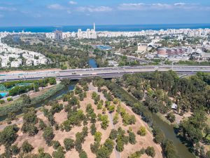
The Yarkon River drains an area spanning from the National Watershed Boundary in the mountains of Judaea and Samaria to the Mediterranean Sea, an area of about 1800 square kilometers. The river’s streams, its drainage channels, mostly start from the mountain and pass through the lowlands and the coastal plain. The flatland area makes up about 25% of the drainage basin, the area drained by the system of streams, and it includes intensive human activity in the form of agriculture, settlement and their derived activities. In terms of the amount of water flowing in the Yarkon, it comes in second place, following the Jordan River. In terms of overall basin area, the Yarkon comes third after the Besor and Jordan rivers.
The drainage basin is divided into two sub-basins: Yarkon and Ayalon. They both drain a similar area, about 900 square kilometers each. The main streams of the Yarkon sub-basin are: Kana, Raba, and Shiloh. The main streams of the Ayalon sub-basin are: Beit Arif and Natuf.
The average perennial rainfall in the basin is between 600 millimeters in the western area and 500 millimeters in the eastern area. The maximum amount was measured at the Beit-Dagan station, 1100 millimeters, in the winter of 1991-92, and the probability of this seasonal amount was calculated at 3%.