District Outline Plans
District outline plans for the Central District (DOP 10/3) and the Tel Aviv District (DOP 2/5) are intended to legally anchor the principles and objectives of the master plan, in accordance with the Planning and Building Law.
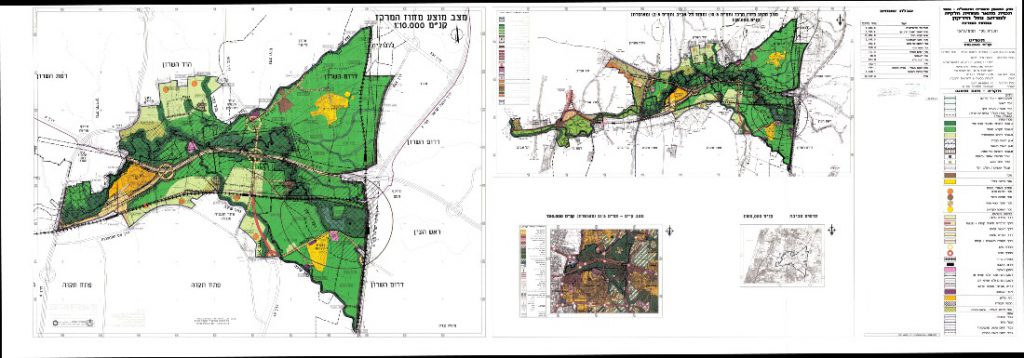
As the area through which the Yarkon River passes is within the area of two districts of the Planning Administration, the plan was prepared as one, but was submitted and approved separately in the two planning districts. The submitter of each plan was the District Planning and Building Commission in each district. The plan was approved in 2008.
The plans present a new planning order in this space, while maintaining open spaces for the common good and preventing the formation of a uniform construction sequence in the center of the country. The plans state for the first time that the starting point for the planning of this space is the open areas included in it and not the development areas, as was actually the case to date in this planning space and other open spaces in the heart of the country.
תשריט תכניות מתאר מחוזיות
DOP (District Outline Plan) 10/3 defines the principal designated land uses in the area defined as “the river area and its surroundings in DOP 21/3 (approved) and the method for rehabilitation, conservation and development of the Yarkon River area as per the program’s objectives. The land uses are more detailed than the ones defined in DOP 21/3, but allow certain flexibility for the planning documents and the local plans that are to follow.
Most of the area of the program includes designated open space of various types. Each designation has a definition, a list of purposes and uses that are possible for development within the designation area, a definition of building rights and provisions unique to that land designation.
The plan’s objectives:
- Conserving a green lung and leisure areas on the metropoline and local level, for the most densely populated area in the country.
- Transforming the Yarkon from the “back yard” to the “front yard” of Gush Dan and improving the qualities of the Improving the qualities of the construction wall towards the open area along the Yarkon River area while designing and stabilizing them.
- Rehabilitating the river’s ecosystem and landscape, safeguarding the continuity of the river system and prevention of nuisances and hazards.
- Setting rules for sustainable development and for the controlled utilization of the economic potential of the land.
- Minimizing the risk of flooding in constructed areas and reducing flooding damage.
The following are the main land designations in the field of plans:
- Rivers
- Land for the conservation of natural and landscape resources.
- Special agricultural land (Central District only).
- Land for extensive recreation.
- Open public land
- Declared national park (Central District only)
- Approved national park (Central District only)
- Land for landscape and visual rehabilitation
- Heritage site/ antiquities site
Plan documents on the Planning Administration website: 2/5 District Outline Plan
For the plan documents on the Planning Administration website: : District Outline Plan 10/3